Country Information Ecuador
| Location |
| |
The state of the Andes has its name because of its situation on the equator. Ecuador is situated in the Northwest of South America and borders in the North on Columbia, in the East and South on Peru and bounds in the West upon the Pacific Ocean. Also the Galapagos Islands, situated in the Pacific Ocean, with a distance to the continent of about 1000 km, belong to the national territory of Ecuador. |
| Population |
| |
About 15 million – 25.000 live on the Galapagos Islands; About 72% Mestizos, 7% Indians, 7% Montubio, 6% Europeans and 7% Afro-ecuadorians, 1% others |
| Capital |
| |
Quito, population 1.9 million
|
| Politics & Economy |
| |
Ecuador is governed by a presidential democracy with a system of federal states. The oil and gas reserves, a variously agriculture, large shrimps producing farms and also the tourism are foreign-exchange earners of the country. The most important agricultural products are bananas, sugar-cane, maize, rice, potatoes, coffee, cacao and lemon fruits. The sea around the Galapagos Islands is one of the richest waters in tuna and Ecuador is worldwide the biggest shrimp exporter. |
| Currency |
| |
US-Dollar since 11. September 2000 |
| Language |
| |
Spanish, partly also Quechua as colloquial language |
| Time difference |
| |
-5 hours GMT |
| Voltage |
| |
110 V alternating voltage; it is recommendable to bring a multiadapter. |
| Public Holidays |
| |
1. January, 12.-13. February (Carnaval), 30. March, 1. May, 25. May, 10. August, 12. October, 2.-3. November, 6. December (Quito), 25. December |
| Opening hours |
| |
Shops, Mon-Fri 09:00 – 13:00ah and 15:00-19:00; Sat 09:00 to 13:00; often, supermarkets do not close before 08:00 and are also opened on Sundays. Banks, Mon-Fri 09:00 – 13:00. |
| Climate |
| |
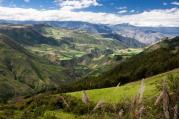
Subtropical or even tropical climate is significant for the western slopes of the Andes. Rainy season is between January and May, dry season between June and December. The average temperature is 25°C – 30°C. The climate of the mountain valleys of the Sierra is temperate and it is very rainy on afternoons and cold in the nights – Quito e.g has a temperature from 8°C – 21°C. The eastern slopes and the jungle are humid and warm. The average temperature of the Galapagos Islands is between 25°C and 30°C with high humidity and sometimes heavy rainfalls. |
| Best time to travel |
| |
The most favourable weather conditions for swimming is from November until April; the one who loves mountain walks in the highlands should travel from June to November and the best time for the regions nearby the Amazon is between August and May. |
| Clothing |
| |
Due to the different climate regions, summer as well as warmer clothes should be taken along . Nights can be very cold! Because of the surprising rainfalls that might come up, rain clothes are always appropriate. Furthermore, you should know that the Ecuadorians like to suit well for going-out in the evenings. |
| Tourist destinations |
| |
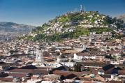
| Quito |
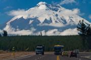
colonial capital; surrounded by snow-covered volcanoes
|
Cotopaxi national park
|
volcano landscape, condors |
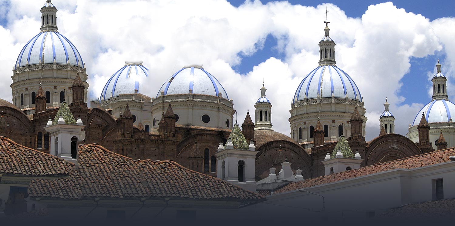
| Cuenca |
colonial style, ruins of Ingapirca
|
| Otavalo |
biggest Indian artisan market of Ecuador
|
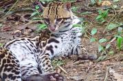
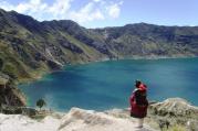
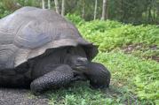
| Galapagos Islands |
unique nature reserve, excellent wildlife observation, research station of Charles Darwin
|
|
| Food & Drinks |
| |
Basic food ingredients, especially in the highlands, are maize and potatoes. Fish, seafood and rice are favourites on the coast. Meat comes from cattle, pigs, goats, wether or chicken. The most important spice of Ecuador is “Aji”, which is an extract of red pods. A typical dessert is the “Torta de maqueno”, a banana cake. After the meals one often takes a cup of coffee; fruit drinks and beer are cheap alternatives to quench your thirst. |
| Souvenirs |
| |
Arts and crafts of Ecuador are promoted by the Government. Popular souvenirs are carpets or other textiles, blankets, hand-knitted clothes, ceramics, panama hats and jewellery. The market of Otavalo is a good place to go shopping. |